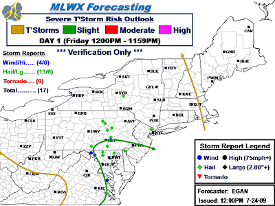
Verification yielded some mixed feelings and results. The end result, without a doubt, yielded enough coverage and amount of reports to warrant a Slight Risk. The fact that I was the only one with a Slight Risk for the better part of the day until early Afternoon when SPC issued a late term Risk upgrade also counts for something. Most of the reports captured in the Slight Risk were on the fringe and located in the northern/western portion. The difference between a so-so and slam dunk end result would have been to capture the 4 hail reports in/around Williamsport with the Slight Risk. As it was, could have probably slightly trimmed back on the south/east extent of Slight Risk, and taken that extra areal coverage and used it to expand a tad north where the 4 hail reports were located, without making the risk area excessively large for the situation, which IMO resembled SPC's outlooks thruout the afternoon.
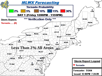
No Tornadoes, not even any warnings, making the tornado threat virtually non-existent Today, which was part the original forecast. SPC did upgrade to a 2% probability for some odd reason with their mid-afternoon update, not sure why.
All in all, certainly not the best I've seen and done before, but can't pass em' all with flying colors.
Total of 17 Severe Weather Reports...
Slight Risk captured 11/17 reports;
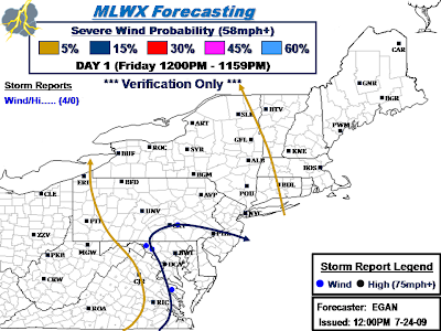
15% Severe Wind Probability: Captured 4/4 measured/estimated severe gusts/wind damage reports.
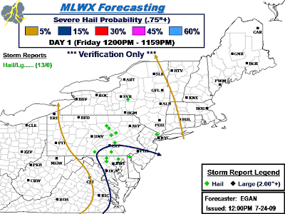
15% Severe Hail Probability: Captured 7/13 severe hail reports.
Isolated Severe captured 6/17 severe weather reports;
5% Severe Wind Probability: Captured 0/4 measured/estimated severe gusts/wind damage reports.
5% Severe Hail Probability: Captured 6/13 severe hail reports.
..EGAN.. 07/25/2009
.png)
.png)
.png)
.png)
Discussion...
No comments:
Post a Comment