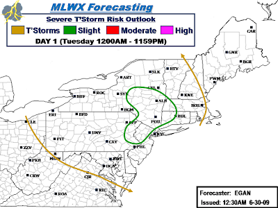
Slight Risk includes the following counties:
New York: Albany, Chenango, Columbia, Delaware, Dutchess, Fulton, Greene, Hamilton, Herkimer, Madison, Montgomery, Oneida, Orange, Otsego, Putnam, Rensselaer, Rockland, Saratoga, Schenectady, Schoharie, Sullivan, Ulster, Warren, Washington, West Chester.
Pennsylvania: Berks, Bucks, Carbon, Lackawanna, Lehigh, Luzerne, Monroe, Montgomery, Northampton, Pike, Schuykill, Wayne.
New Jersey: Bergen, Essex, Hudson, Hunterdon, Mercer, Middlesex, Morris, Passaic, Somerset, Sussex, Union, Warren.
Connecticut: Fairfield, Hartford, Litchfield, New Haven.
Massachusetts: Berkshire, Franklin, Hampden, Hampshire.
Vermont: Bennington.
Discussion...
Overall consesus is that there will be a corridor of moderate MLCAPE on the order of 1350-2000 J/KG that develops this Afternoon/Evening over parts of the area. In conjuction, corresponding moderate negative LI's of -3 to -6 and Low Level Bulk Shear of 25-40kts (highest in the Southern portion of Risk) will be in place over this region thruout the Afternoon and into the Evening. This should allow for fairly widespread convection to fire this Afternoon, some of which will likely become severe.
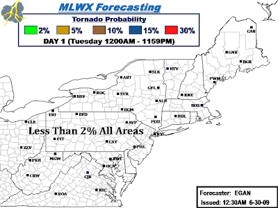
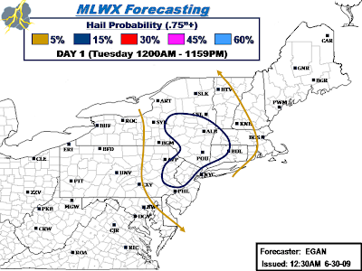
Given lack of strong low level shear, storm organization will likely be fairly loose and feature Multi-Cell clusters/Pulse storms. Given the rather low freezing level in the mid-layers, expect hail to be the primary severe threat versus damaging winds. Have played this potential up in the Outlook probabilities. That said, isolated damaging wind gusts may still accompany the strongest cells.
Final Day 1 Outlook to be completed by midday, which may or maynot feature any changes to current Outlook.
..EGAN..
.png)
.png)
.png)
.png)
No comments:
Post a Comment