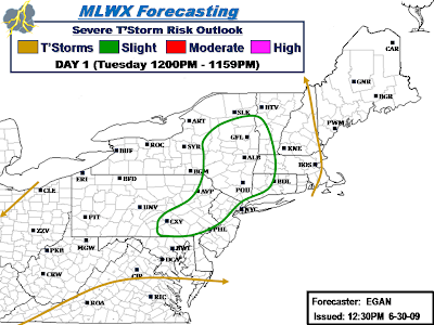
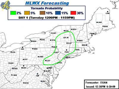
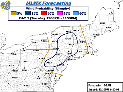
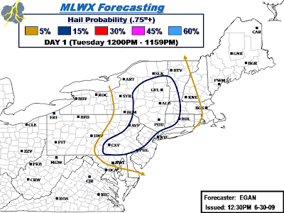
Tornado threat is still very low, but given some decent helicity being indicated by the latest RUC guidance (highest in the north), tornado threat is non-zero. Best chance for a brief isolated tornado will be with any discrete low-topped supercells that manage to develop this afternoon.
Newly updated Slight Risk includes the following counties...
New York: Albany, Chenango, Columbia, Delaware, Dutchess, Essex, Fulton, Greene, Hamilton, Herkimer, Madison, Montgomery, Oneida, Orange, Otsego, Putnam, Rensselaer, Rockland, Saratoga, Schenectady, Schoharie, Sullivan, Ulster, Warren, Washington, West Chester
Pennsylvania: Adams, Berks, Bucks, Carbon, Chester, Columbia, Cumberland, Dauphin, Delaware, Juniata, Lackawanna, Lancaster, Lebanon, Lehigh, Luzerne, Monroe, Montgomery, Northampton, Northumberland, Perry, Philadelphia, Pike, Schuykill, Snyder, Susquehanna, Wayne, York.
New Jersey: Bergen, Essex, Hudson, Hunterdon, Mercer, Middlesex, Morris, Passaic, Somerset, Sussex, Union, Warren.
Connecticut: Fairfield, Hartford, Litchfield, New Haven.
Massachusetts: Berkshire, Franklin, Hampden, Hampshire.
Vermont: Addison, Bennington, Rutland, Windham.
.png)
.png)
.png)
.png)
No comments:
Post a Comment